 With the UK’s water infrastructure valued at over £200 billion and worth over £10 billion per year, Britain’s 389,000 km of river ecosystems are among our most important natural assets. They provide water and other major ecosystem services such as regulating floods and water quality, supporting adjacent ecosystems with energy and nutrients, and large cultural value for charismatic organisms, recreation, and education.
DURESS will investigate how organisms and ecosystem functions maintain river ecosystem services. This is crucial knowledge because they are affected by pollution, catchment land use and climate change. The cost implications of these effects are large, for example for recreational fisheries, water treatment and high-value river biodiversity. By contrast, there is large potential to manage rivers and their catchments positively to increase the ecosystem service value of rivers by enhancing beneficial in-river organisms.
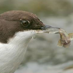
DURESS focuses on four river ecosystem services that are biodiversity-mediated: the regulation of water quality; the regulation of decomposition; fisheries and recreational fishing; and river birds as culturally valued biodiversity. Each is at risk from climate and land-use change, and potentially sensitive to disturbance at different thresholds and at different time-scales.
The four services chosen for investigation vary in attributable market values, and to understand them requires integration from the physical, biogeochemical, ecological and socio-economic sciences that the project partnership provides. Using river microbes, invertebrates, fish and river birds at levels of organisation from genes to food webs, DURESS will test the overarching hypothesis that: Biodiversity is central to the sustainable delivery of upland river ecosystem services under changing land-use and climate.
DURESS ranges from small experimental catchments to the whole uplands of Wales, and at time steps from weeks to decades. We chose upland Wales specifically as a well-defined geographical area of the UK that is particularly rich in the spatially extensive and long-term data required for the project, and where rivers are major landscape features.
